Importance of Satellite Imagery and Drones in Data Acquisition
Satellites go beyond being distant objects in space, they are technology that’s actively reshaping agriculture. From weather forecasting to precision agriculture, they have become indispensable tools for farmers worldwide who rely on satellite imagery. Today, as satellites redefine space access, the future of agriculture is poised for even greater innovation.
Making well-informed decisions requires access to vast amounts of data and a comprehensive understanding of that data. To be more precise, the ability to gather, analyse and interpret large datasets is essential for identifying trends, patterns, and correlations that inform decision-making processes.
Why We Need Data Acquisition
The initial step in implementing precision farming is data acquisition. To gain valuable and accurate insights, it is necessary to obtain a wide variety of data from different sources and locations. Higher data density enables a more detailed overview of fields and crops.
How does this fit in with agriculture? Well, information from our fields, covering crops, soil, weather, and climate, is crucial for efficient precision farming. Understanding these measurements and their practical applications is essential for deriving meaningful insights. These insights can help farmers to manage their operations better and improve decision making.
In the past, the only method of collecting data was visual observation and learning from actions taken in the field. However, with technological progress, various data collection methods and tools are introduced, such as satellites, drones, sensors, machinery, etc. These new methods enable a new depth of observations, providing farmers with comprehensive insights into their fields.
From Space to Field: Satellite Imagery Is Optimising Farming
Satellites play pivotal roles in revolutionising data collection methods, particularly in agriculture. Satellites capture large-scale imagery, providing an aerial perspective of a complete picture of their fields. This perspective enables farmers to monitor crop health, identify areas of stress, and assess overall field conditions on a broad scale.
Satellites are revolutionising precision farming practices in several ways:
1. Remote Sensing and Field Surveillance
Remote sensing satellites offer crucial information for tracking soil conditions, snow cover, drought, and crop growth. This enables growers and crop advisors to compare fields, pinpoint areas of crop stress, forecast plant health and overall crop yield. Additionally, this technology provides timely updates on moisture levels, disease outbreaks, structural irregularities, and nutrient statuses. This data aids farmers in making timely and precise interventions, optimising crop growth, and mitigating potential losses. The integration of satellite remote sensing with field scouting is particularly effective in identifying deviations from expected patterns.
2. Real-Time Weather Data from Satellites
Satellites play a crucial role in providing farmers with real-time and detailed weather data, empowering them to make informed decisions. By monitoring weather patterns, farmers can foresee adverse conditions such as heavy rainfall, storms, or frost. This foresight enables them to adapt planting and harvesting schedules, thereby reducing potential losses and optimising crop quality. In the face of risk assessment, this proactive approach enables them to implement preventive measures, such as selecting more resilient crop varieties or adjusting irrigation practices.
3. Enhancing Resources through Soil Mapping
Satellite data enables farmers to assess soil conditions on a large scale. Analysing imagery and geospatial data allows them to detect variations in soil properties such as nutrient composition, moisture levels, and overall structure. This valuable information empowers farmers to optimise the application of fertilisers and irrigation, adjusting their strategies based on the unique requirements of diverse areas within their agricultural fields. Furthermore, satellite-based soil mapping assists in pinpointing vulnerable zones susceptible to erosion, enabling farmers to implement preventive measures to safeguard soil health.
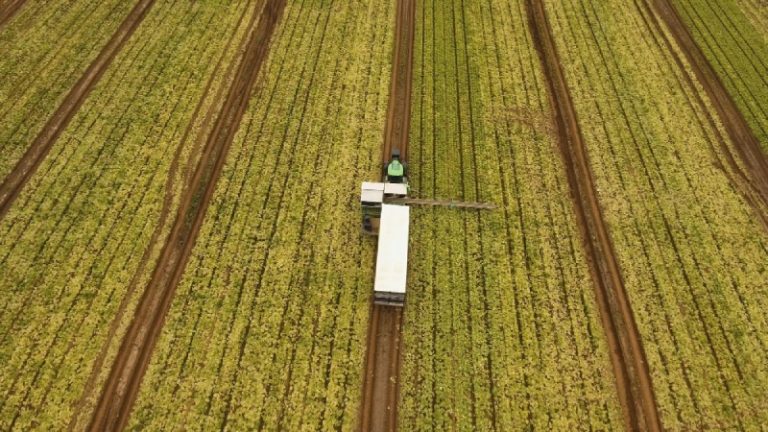
4. Innovations in Field Scouting and Yield Prediction
Field scouting and yield estimation have traditionally required farmers to conduct physical inspections of their crops. Now, satellites provide an aerial perspective allowing farmers to quickly scan large areas. Moreover, it helps them spot issues like crop stress or potential diseases without having to physically walk the fields. Also, by combining satellite data with machine learning, farmers can better predict crop yields, making planning and market forecasting easier.
5. Satellite Documentation for Regulatory Compliance
Satellites play a crucial role in documenting and reporting farming activities, aiding farmers in showcasing their practices for regulatory compliance and certification purposes, particularly in sustainable agriculture. By utilising satellite imagery and data, farmers can provide detailed records of their land use, crop rotations, and management practices over time. Moreover, using satellite data for documentation and reporting, farmers can enhance transparency in their operations, build credibility with consumers and stakeholders, and contribute to the advancement of sustainable agriculture on a global scale.
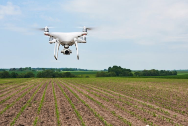
Drone Perspectives: Precision Agriculture from Above
The European Union anticipated a rise in the number of active IoT connections in agriculture. In 2022, this figure stood at 46.92 million connections and is projected to climb to 70.26 million by 2025. Among the various applications of IoT devices in agriculture are employing drones for surveillance and seed distribution.
As opposed to satellites, drones offer a more localised and precise view of fields. With their ability to fly at lower altitudes and manoeuvre through tight spaces, drones capture high-resolution images with unparalleled detail. This allows farmers to zoom in on specific areas, detect subtle changes, and gather precise data on crop growth, pest infestations, and soil conditions. By combining insights from satellites and drones, farmers can gain a comprehensive understanding of their fields, leading to more informed decisions and optimised agricultural practices.
The STELAR Project's Role in Data Acquisition
The STELAR project, part of the Horizon Europe initiative spanning three years, aims to simplify the use of agrifood data by creating data value chains tailored to today’s needs, addressing challenges like data discovery, integration, and interoperability across the food supply chain.
With data coming from diverse sources and applications, each with its own structure and format, STELAR is developing a Knowledge Lake Management System (KLMS). This system makes it easier to connect and understand different types of data, ensuring accuracy and scalability. Considering the immense volumes of data involved in data acquisition, the system’s effectiveness in managing large volumes of information proves highly advantageous.
One of the pilots within our project, ABACO group, is dedicated to enhancing timely precision farming interventions. Specifically, this pilot aims to integrate various data sources, including spatial and agronomic data from satellites, and provide them to a food processing equipment supplier. The goal is to enhance the efficiency of their processes while also conserving energy and resources.
Conclusion
The integration of satellite technology into agriculture has ushered in a new era of precision and efficiency for farmers worldwide. Looking ahead, our upcoming blog post will furthermore delve into the vital role of sensors in data acquisition for precision farming.
Stay tuned as we explore how sensor technology complements satellite data and check out our Blog and LinkedIn page.